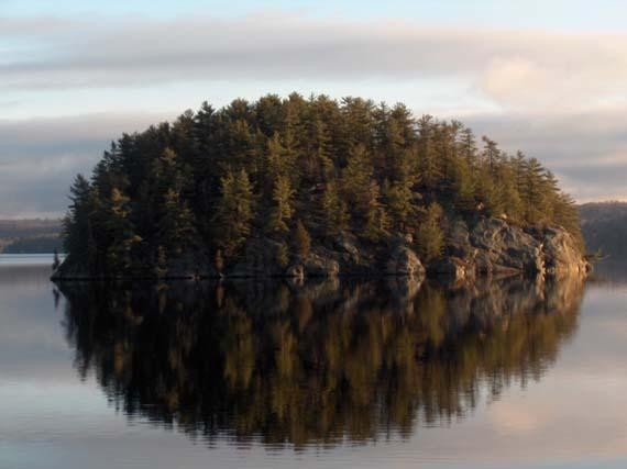

Mary Lake is the Jewel in the Crown of Muskoka. It lies in a NE to SW line half way between Bracebridge and Huntsville and is part of the North Muskoka River The present lake basin was sculpted by the last ice age but the Precambrian rocks date back millions of years. Eight islands dot the lake and were likely volcanic pipes that were once buried deep in the ancient mountains. The largest of the islands is Crown Island and is the signature island in the scenery of the lake. There was a family called Crown who lived briefly in Port Sydney .The Indians thought of the island as the back of an otter. Deadman's Island heads a line of islands starting in the northeast. Captain Cock lies buried there. Snowshoe and Forrest formerly called Rumball's Island lie SW of that. Crown and the Isle of Pines with Rocky Island closest to Port Sydney are at the south end of the lake. Lawrence Island is the last one in the northwest part of the lake. It is named after a family who lived at the north end of the lake where Gryffin Lodge is located.
Indians travelled through this area regularly on their way to what is now Algonquin Park. Their families were frequently left on the shores of Mary Lake while the hunters went on to the north. The Indians were of the Rama Tribe and came from Orillia area. A chief by the name of Menominee camped on the lake in the 1860's and 70's.
The lake was surveyed by Alexander Murray in 1853 and he called it Mary's Lake after his eldest daughter. It was not long after that in the late 1860's that the first settlers arrived. By that time the areas close to Lake Ontario were well settled and rather than have the flood of settlers coming from Europe go further west, the government built settlement roads into the region. Cheap land and great stands of pine lured settlers into the area.
This began a period of thirty years where lumbering was the main activity around the lake. The settlers who thought that they could farm were soon disappointed after they cleared the land and found that the thin topsoil soon washed away. The pine trees belonged to the government and the only employment was in the forests and in the mills. The largest mill of the four around the lake was owned by Sydney Smith after whom the town was named and who was a benefactor to the town.